
Valentine Geze, Bradley Wagman, and Yaluo Wang; Moses Hurricane Net flood sensor and predictive mapping network for Asheville, NC; STU 1231: Collaborative Design Engineering Studio I; Harvard Graduate School of Design, 2024.
About.
This project was conducted in partnership with two peers in the MDE program, Bradley Wagman and Yaluo Wang, under the professorship of Justin Cook and Siqi Zhu.
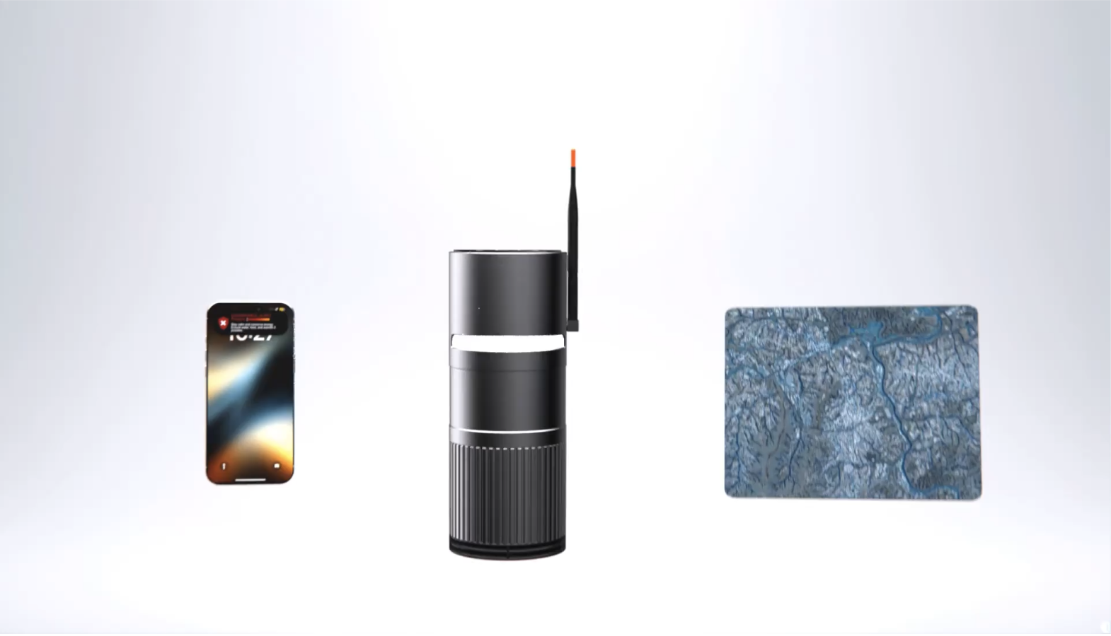
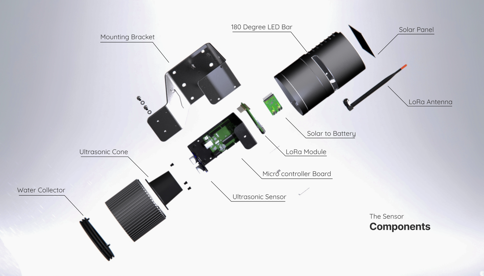
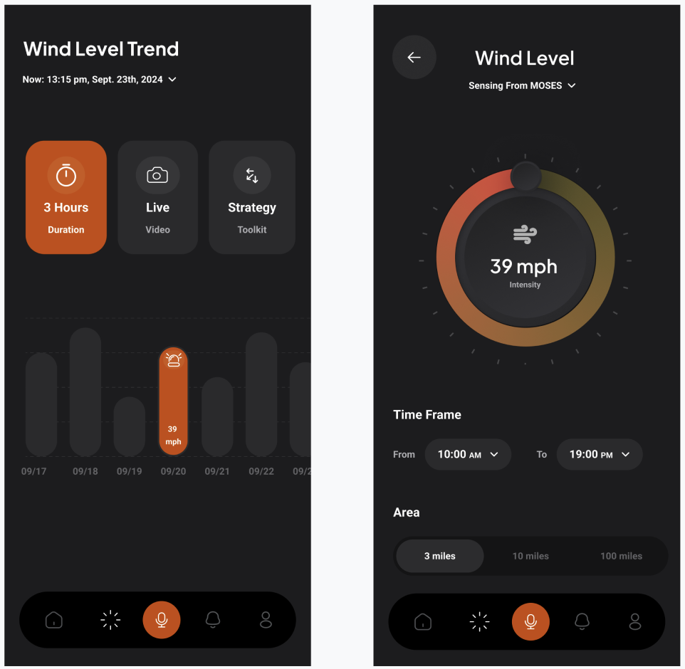
Moses tackles rising floods in unprepared U.S. cities with a predictive sensor network and real-time alerts. Ultrasonic sensors, housed in durable, solar-powered casing, measure water levels and transmit data via LoRa. GIS-based flood simulations guide sensor placement for strategic coverage. The system analyzes water level changes and topography to forecast short-term flood developments. Residents receive curated push notifications, helping them anticipate how flooding will unfold and take action. By combining durable sensors, predictive modeling, and alerts, Moses empowers communities to navigate floods safely and reduce risk.
GIS Statistical Analysis.
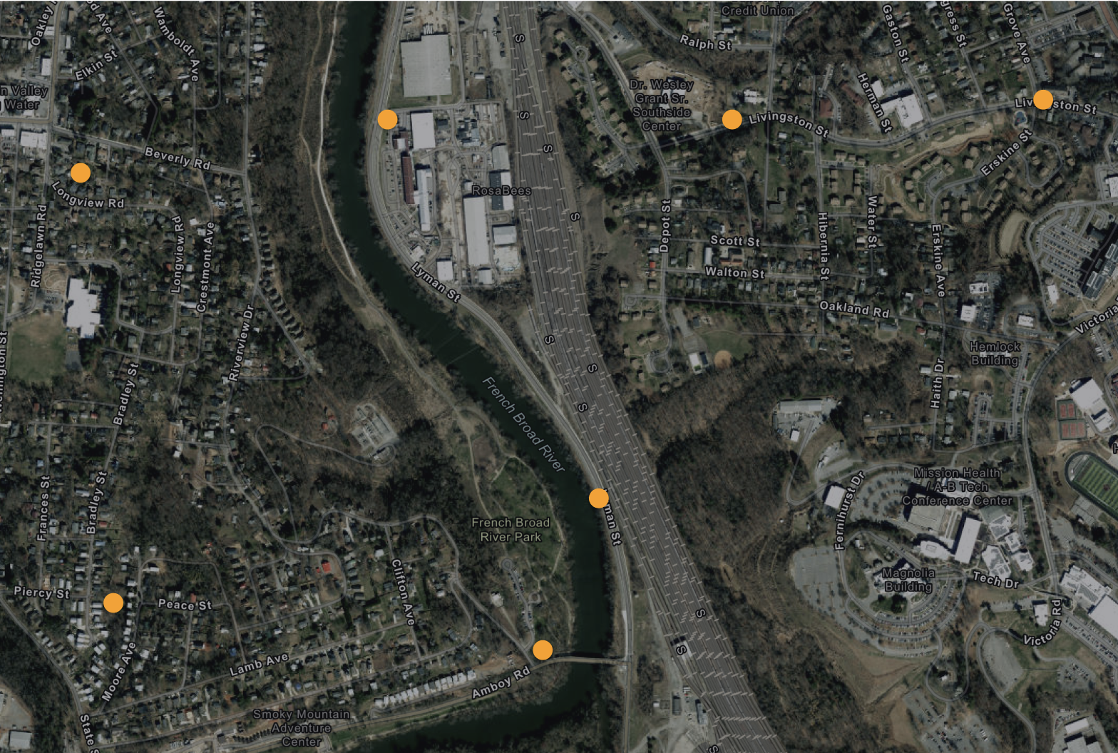
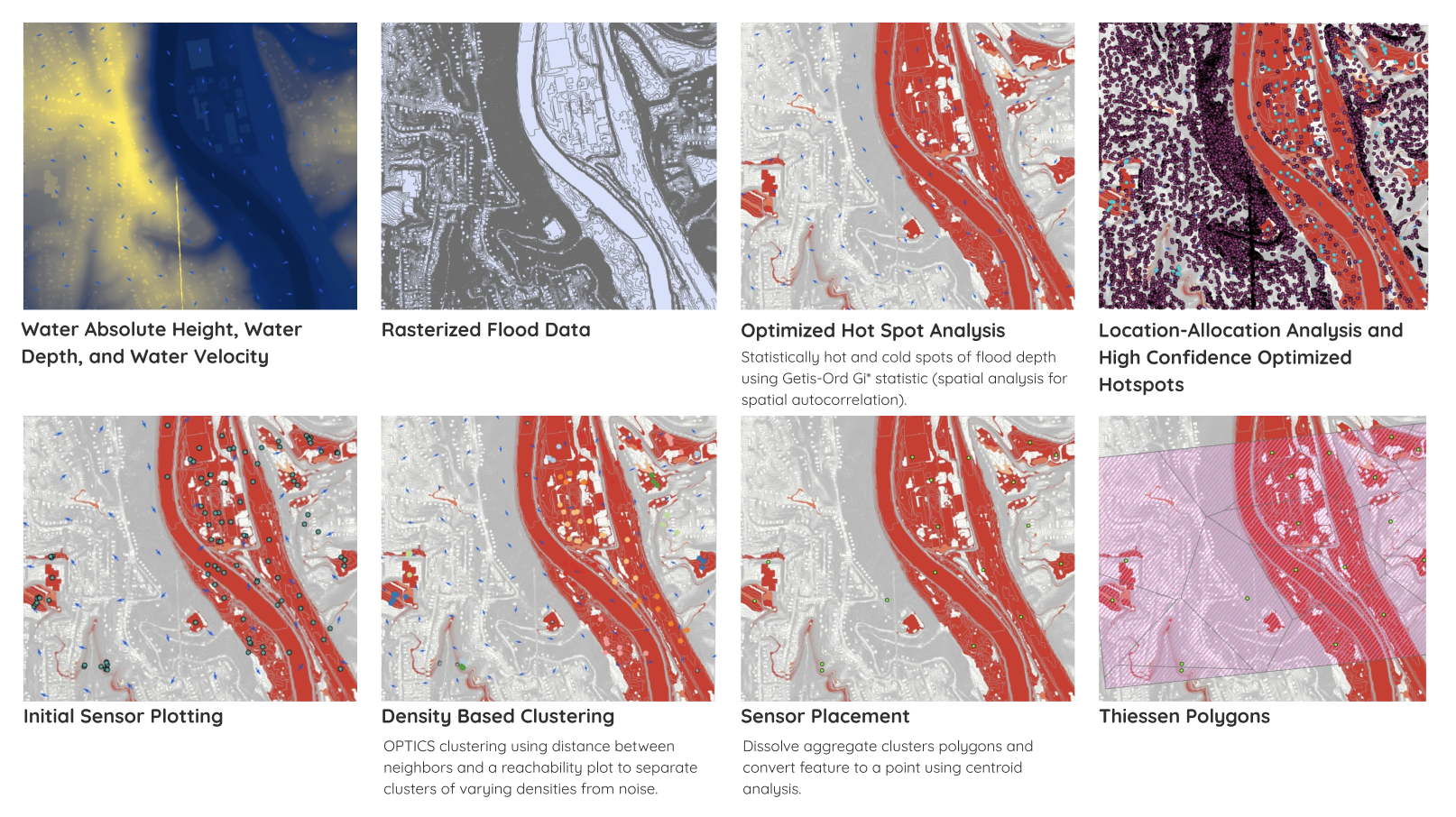
The component on which I focused in this project is the geospatial analysis for strategically placing the sensors. This project was developed by using Asheville, North Carolina during Hurricane Helene as a case study. I began by running a flood simulation in GIS to determine absolute water height and velocity during a flood event in Asheville. I then used optimized hot spot analysis to find statistically hot and cold spots of flood depth, which informated a location-allocation analysis and high confidence optimized hotspots. These results permitted an initial sensor plotting, after which I used density based clustering and Thiessen polygons to aggregate the sensor plots and decrease the density of sensor distribution.
Ethnography.
A critical component of this work was the ethnographic research conducted to make the design relevant to those it really impacts. We used Reddit to speak with survivors of Hurricane Helene in Asheville received hundreds of pages of narrative and interview notes from longtime residents, which heavily shaped our design choices. Further, we spoke with catastrophe response researchers, FEMA deputies, and scientists focused in weather radar research to develop our project.